|
Mike and I
originally planned to do a trip in the White Mountains of New
Hampshire this weekend, but when
the lows were
forecasted to
-16 degrees we decided the Adirondacks would be a better place
.
When we
signed in at the Adirondack Loj Friday around noon the
current weather forecast for the area had changed.
The forecasted
low was now -20 for Friday night and -25 for Saturday night. The
average high for each day
was 0 degrees. So we headed off toward
Avalanche Pass (approx. 4 mile trip) to find a campsite.
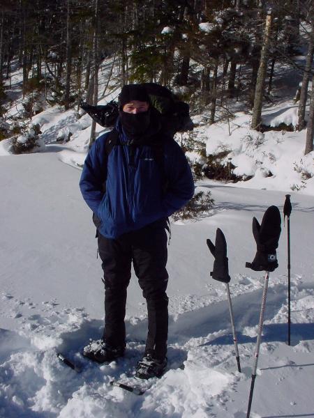
Quickly we started
learning things about just how cold it was. My digital camera
would not work. It was
too cold for the battery. I tried some
brand new double A's in the camera. They did not work either. Not
until
the second day did I get a system down of keeping the
battery deep within my clothes for warmth. When I
wanted to take
a picture, I'd pull the camera out of Mike's pack (easier to get to
then my own), take off one
of my gloves, dig out the battery, put
it in the camera and snap a few shots before the battery or my hand
got too cold. My hand would usually outlast the battery. I
could only get 3 or 4 shots at a time before the
battery would
have to be tucked away again. The camera itself would get a light
coating of ice on it from my
breath each time.
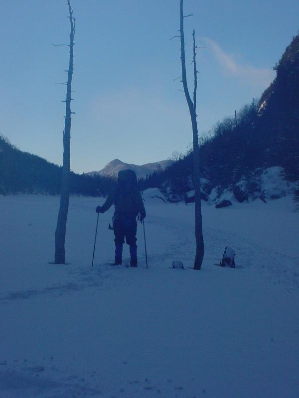
So this is the
first picture taken on the second day. This is Mike standing near
the banks of Lake Colden
before we crossed to the other side.
.
|
 |
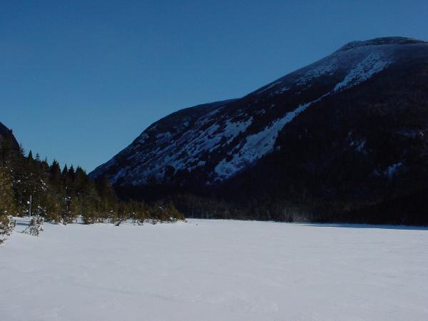
Looking to the
east corner of Lake Colden you see Mt. Colden at 4714 ft. We briefly
thought about
going over Mt. Colden, but after having the wind
whip and beat at us crossing Lake Colden, we decided it
was safer to stick to the
valleys. To see a panoramic shot of this end of Lake Colden, click here
.
|
 |
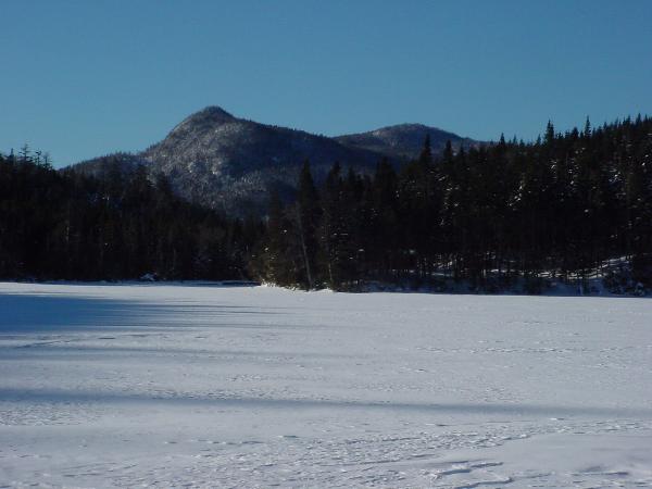
This is the view to
the west end of Lake Colden. I think that's Calamity Mt. The lake
had about a foot of
snow on it. It was thicker and
thinner in
place
due to drifting.
|
 |
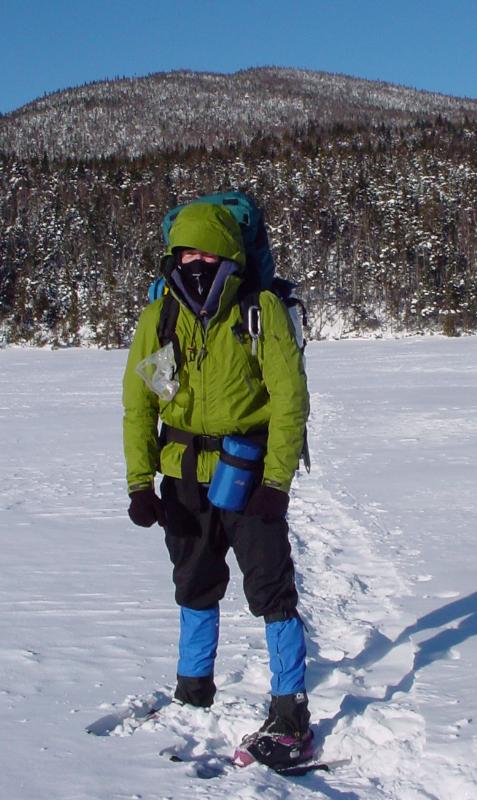
Here's a picture of me
on Lake Colden. The white stripe you see down the front of my
balaclava is ice
created from my breath. On my waiste belt
you can see my water bottle in its insulating cover. It
would take
about 4 hours before the lid would freeze to the
bottle. This was the first time for both us using
snowshoes.
The learning curve is quite easy and fun, but
we both took some serious falls on narrow bridges because
of
the snowshoes. You can also see my pink hard plastic
mountaineering boots. These boots are fantastic
for cold weather
adventures. They have an insulated inner boot that keeps your feet
totally warm, while the
hard plastic shell keeps your feet
dry
and well supported.
|
 |
To the north of Lake
Colden is Algonquin peak. Algonquin peak is the second highest peak
in New York at
5114 ft. Jen and I went up
Algonquin in July this past summer. Click
here
to see a picture of Jen on
the
peak. To see a panoramic picture of
Algonquin and Iroquoise peaks, click here
. At the bottom you
see
the Lake Colden Interior Outpost. It's a year-round
ranger station used for Adirondack High
Peaks
emergencies.
|
 |
Here we
are headed back to Adrirondac Loj to head home. With 40lb+ packs we were moving
at 1.5 mph.
|
 |
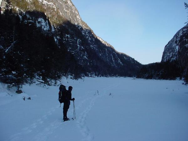
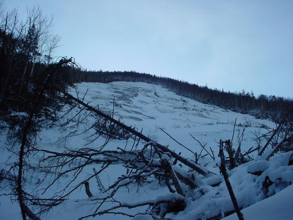
This is Mike at the
beginning of Avalanche Lake. The wind was wipping into our faces the
whole way across.
In the summer, the trail hugs the left hand
side of the lake. In two places it uses wooden catwalks built into
the sheer rock faces that drop into the lake. There's also a
series of ladders and other wooden structures to
get you over
and around the boulders and
other
rock features along the
lake shore.
|
 |
A
picture
of
the south side of
Avalanche Lake.
|
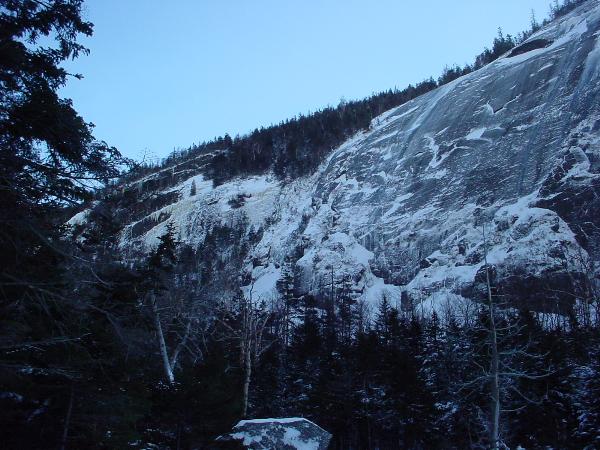 |
A
picture of the cliffs dropping into Avalanche Lake.
|
 |
A picture of me at the east end of Avalance
Lake. Behind me you can Calamity Mt. all the way at the
west
end of Lake Colden. I think the blur or cloudiness of
the picture was caused by Mike's breath or a thin
film
of ice forming over the lens.
|
 |
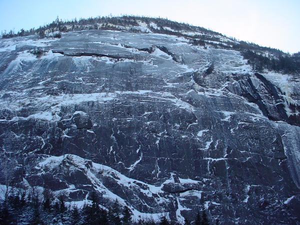
This is why the trail is
called Avalanche pass. The trail (and Lake) runs through a
narrow valley with sheer or
very steep slopes on either side
prone to land slides. This particular slide occurred in 2000 after
hurricane
Floyd
|
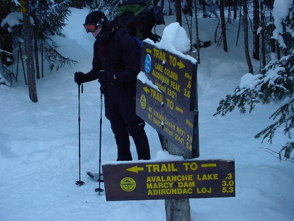
 |
The route we took
started from the Adirondak Loj. We took the Van Hoevenberg
trail (61) to Marcy Dam, where
we picked up the Avalanche
Pass Trail (68). After Avalanche Lake we took the trail around the
Northwest shore
of Lake Colden (69). The return trip was
very similar, though we went straight across Lake Colden instead
of
taking the trail around it.
|
Lessons learned about winter camping and the
Adirondacks.
|
|
|